Weather Satellites
What is a Weather Satellite?
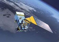
The weather forecaster’s most valuable tool for
creating long-term weather forecasts is the weather satellite. Weather
satellites provide meteorologists with pictures and other information about
hurricanes and tropical storms that occur over the oceans and points on land
that are beyond the range of surface weather stations (Engelbert, 1997, p. 415).
Weather satellites make it possible to view storms from space and to monitor
weather conditions continuously around the planet.
For most people, the words “weather satellite” conjures up images of
swirling clouds like those seen on television newscasts. However, their
function is far more extensive. Weather satellites determine the temperature at
various atmospheric levels, from cloud tops down to the land and oceans
(Engelbert, 1997, p.416). They measure humidity and wind speeds in the upper
air, and even track shifting regions of invisible water vapor (Engelbert, 1997,
p.416). Weather satellites relay information from one ground station to
another, as well as pick up and transmit distress signals from vessels from the
air and sea (Engelbert, 1997, p.416). Satellite images are representations of
the real world constructed from measurements of the brightness or intensity of
electromagnetic energy which is measured by devices remote from the actual
scene (Mayes
& Hughes, 2004, p.3).
Types of Radiation Withtin Weather Satellites
Two types of radiation emitted by Earth with imaging equipment on board satellites
are visible and infrared (Engelbert, 1997, p.416).
are visible and infrared (Engelbert, 1997, p.416).
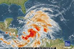
Infrared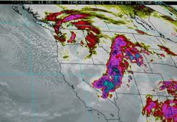
Infrared radiation is heat that is lost from the Earth’s surface (Engelbert, 1997, p.417). These pictures are produced by infrared sensors which are essentially a roadmap of the temperature of the cloud tops; the higher the cloud top, the lower the temperature (Engelbert, 1997, p.417). This image also depicts the location and intensity of a thunderstorm; the higher the cloud top, the greater intensity of a thunderstorm (Engelbert, 1997, p.417).
|
Visible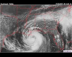
Visible radiation is reflected sunlight. On
board satellites take what is basically a black-and-white photo of the visible radiation (Engelbert, 1997, p.417). Cloud patterns are seen on these pictures, as well as surface features larger than about a half of a mile across that are situated under clear skies (Engelbert, 1997, p.417). With these pictures, it is possible to distinguish storm systems, fronts, thunderstorms, hurricanes, topographical landmarks, and even snow cover on land (Engelbert, 1997, p.417). |
Weather satellites fall under two categories;
geostationary and polar orbiting. Geostationary satellites remain stationary
above a given point on the equator, traveling at the same speed as Earth’s
rotation around 22,300 miles above the Earth’s surface (Engelbert, 1997, p.417).
Polar orbiting satellites travel north-south routes, crossing over both poles
500-620 miles above the Earth’s surface (Engelbert, 1997, p.417).
Simultaneously, these two satellites constitute a complete global weather
monitoring system (Engelbert, 1997, p.417).
